Er du på vei til Bodø? Da bør du vurdere å skaffe deg en leiebil som venter på deg når du kommer frem. For du kan oppleve mer av det byen og områdene rundt byr frem når du kjører egen bil. Du slipper å ta hensyn til buss- eller togtider. For å oppleve mange av de spektakulære attraksjonene rundt byen må du nesten ha tilgang til et kjøretøy som du råder over selv.
Leiebil på Bodø lufthavn
Hvis du ankommer Bodø med fly, lander du på Bodø lufthavn. Her finner du firmaer som Sixt og Budget. Hertz har også et kontor i nærheten av flyplassen. Du skal med andre ord ikke behøve å bevege deg veldig langt før du kan plassere bagasjen din i en leiebil og kjøre av gårde. Du kan også prøve sammenligningstjenester for leiebil som Go Autos – Bodø.
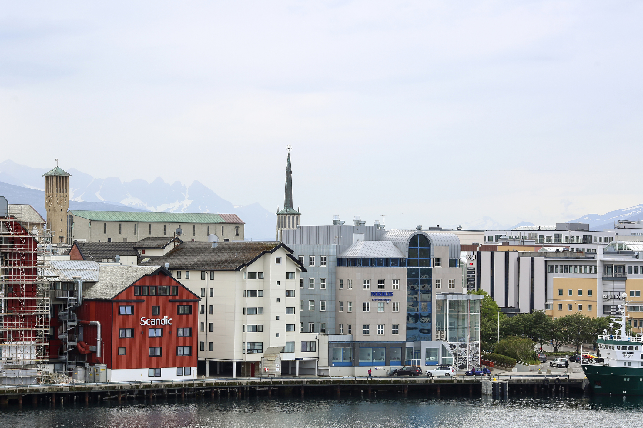
Bodø er en grei by å kjøre i. Hålogalandsgata går gjennom store deler av byen og ender i Vestbyen, hvor du for øvrig finner Sixt Bilutleie også. I den samme bydelen finner du mange av Bodøs shoppingmuligheter, flere parkeringshus og Nordlandsmuseet, som deler adresse med Bodø bymuseum. Ønsker du å ta ferge ut i havgapet ligger fergekaien like i nærheten.
Øst for flyplassen ligger Norsk Luftfartsmuseum. Det er godt med parkering i området. Litt lenger bort finner du City Nord som er et av Nord-Norges største kjøpesentre. Jo, du kommer deg frem med buss til alle disse stedene, men det går kvikkere med en leiebil.
Bomstasjoner
 Det finnes flere bomstasjoner i Bodø. Du må blant annet betale hvis du skal kjøre gjennom Bodø-tunnelen. Skal du kjøre til Knaplundsøya for å oppleve Saltstraumen må du passere Godøystraumen bomstasjon. Også på riksvei 80, like før Fauske, er det satt opp en bomstasjon ved Strømsnes. Det varierer hvor mye du må betale for hver passering. Når du kjører med leiebil, blir kostnaden som regel lagt til leiebilregningen automatisk. Det skader likevel ikke å spørre leiebilfirmaet om hva du bør tenke på når du passerer et betalingspunkt.
Fra Bodø kan du også ta ferge over til Lofoten. Når dette skrives er Autopass på fergene i ferd med å bli innført. Forteller du den som leverer deg leiebilen at du har tenkt deg med fergen over til Moskenes for eksempel, vil du få beskjed om hvordan betalingen for fergeturen skal foregå.
Storslått natur
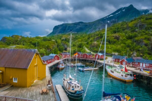 Bodø er preget av vill, vakker og storslått natur i alle himmelretninger. Vi har vært innom både Lofoten og Saltstraumen. Etter at du har sett Saltstraumen kan du kjøre fylkesvei 17 videre til at du kommer til Glomfjord. Her kan du starte turen til Svartisen.
Bilutleie Bodø
Nord-Norge står øverst på ferielisten til stadig flere nordmenn. Mange bruker Bodø som utgangspunkt for sitt nordnorske eventyr. Det kan være rift om de beste leiebiltilbudene, spesielt om sommeren. Derfor kan det lønne seg å være ute i god tid med å bestille leiebil i Bodø.
Du kan bruke vårt leiebilsøk til å sammenligne priser på biler. Når du finner en bil du liker kan du bestille bilen direkte fra våre nettsider hos alle de store utleiefirmaene.